US Weather Split: Wet Northwest Meets a Deep East Freeze
It is a week defined by stark atmospheric contrasts across the United States, serving as a reminder of the complex and often volatile nature of our changing weather systems. As we settle into the winter season, the country is currently divided by two distinct and powerful meteorological phenomena. While one coast is being inundated by relentless moisture, the other is shivering under a descending blanket of arctic air.
In the Pacific Northwest, the weather story is one of saturation. A series of potent atmospheric rivers—long, narrow regions in the atmosphere that transport most of the water vapor outside of the tropics—are currently slamming into the region. These "rivers in the sky" are unleashing heavy precipitation, leading to significant flooding concerns. The deluge is testing infrastructure and water management systems, highlighting the intensity of modern storm systems.
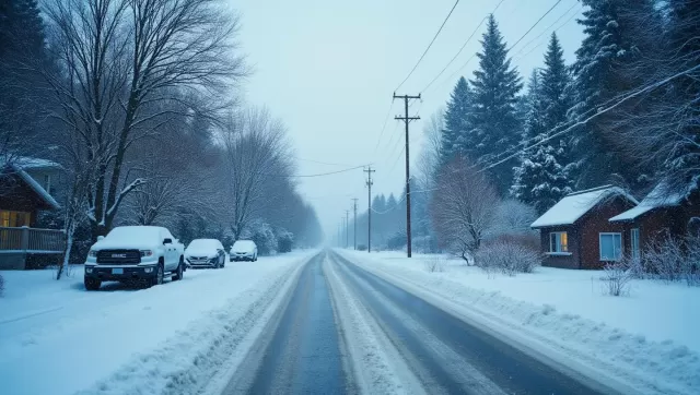
Conversely, the eastern portion of the country is grappling with a different extreme: a biting chill. Colder-than-normal temperatures have taken hold, keeping much of the East Coast and the Midwest in a deep freeze. This is not merely a fleeting cold snap; temperatures are plunging significantly this week, with forecasts suggesting they could drop precipitously once again before we see any relief. Meteorologists anticipate that more typical, seasonal temperatures may not arrive until later in December, requiring residents to bundle up and prepare for a sustained period of cold.
Understanding the "why" behind this winter's weather map requires looking at the broader climatological patterns at play. According to the National Oceanic and Atmospheric Administration (NOAA), the La Niña weather pattern is the primary driver for the season ahead. NOAA forecasts indicate that La Niña is set to linger throughout this winter. Typically, La Niña events are characterized by cooler-than-average waters in the central and eastern tropical Pacific, which impacts global weather patterns. For the U.S., this often translates into wetter, cooler conditions in the North and warmer, drier conditions in the South, creating the kind of split-screen weather reality we are witnessing this week.
However, even within these seasonal forecasts, we must look closely at the data to understand the long-term context of our changing climate. A prime example of this can be found in the Great Lakes region. The U.S. National Ice Center has issued a prediction for "near normal" ice cover for the Great Lakes this winter. On the surface, this sounds like a return to stability. However, this prediction comes with a significant caveat that highlights the reality of a warming planet.
The definition of "normal" is shifting. The Ice Center's prediction is based on the "recent normal"—averages drawn from the last few decades—rather than long-term historical normals. When viewed through a wider historical lens, the baseline has moved. Ice cover in the Great Lakes region has been in a steady decline for decades, a clear symptom of rising global temperatures. Therefore, a winter that is considered "average" by today's standards would likely have been considered exceptionally mild or low-ice just half a century ago.
As we move through this week of firehose rains in the West and freezing winds in the East, it is vital to remember that these events are pieces of a larger puzzle. From the persistence of La Niña to the shifting baselines of our icy landscapes, the environment is telling us a story of change.